 |
| Beautiful Fall colors on the Alaska Highway headed south from Whitehorse, Yukon. |
After two days in Whitehorse, we headed south back down the Alaska Highway. We were originally planning on taking the Cassier Highway (Hwy 37) south through British Columbia. But it is closed for over 200 kilometers due to mudslides and flooding. So we went about 100 miles further east and took Highway 29 and Highway 97 south to Prince George. The fall colors are beautiful. We even saw some wildlife - elk, bison and a mother black bear with her three cubs.
 |
| Miles Canyon just south of Whitehorse. Before the river was dammed, the rapids in this canyon were almost impossible to cross. The stampeders had to pay to have their stuff portaged around the canyon. |
 |
| On the Alaska Highway. |
 |
| Wood Bison near Liard Hot Springs. |
First night out of Whitehorse, we stayed at an RV park on the shores of Muncho Lake. The spot was beautiful with a very nice view of the lake. That is, until a huge 5th wheeler pulled up in the adjacent campsite and completely blocked our view. Then they opened their slideouts and we became VERY close neighbors. The campsites were just too small for that size of RV. Sigh…
 |
| View of Muncho Lake from our campsite, before the monster 5th wheeler showed up. |
 |
| The lake was smooth as glass when we left the next morning. |
 |
| Elk on the highway. |
 |
| We had been warned about the extreme dust clouds that could occur on the areas of the highway that were gravel, but this is the first time we really had the full experience. Just like being in a thick fog. |
Third night out was even more interesting. There are NO campgrounds between Fort Nelson and where we were turning south on Highway 29. The provincial parks are closed (not that there were that many provincial parks anyway) and the few RV parks that existed are out of business. We finally stopped at one place that was open but it was full. They said that another hour down the road there was a campground at Wonowon. By this time, it was dark and I don’t like driving in the dark where there are wild critters (hit a deer in Michigan driving at night a few years ago….not fun). But we headed out. Well…when we got to Wonowon, we found a gas station that had a convenience store and nothing else. There hadn’t been a campground there for a very long time! They said that an hour down the road, there is a campground. Now, where have we heard that before? So they offered to let us pull over in the dirt lot next to the gas station for the night. We ended up boondocking (that is dry camping) for the night and it worked great! A bit noisy, what with the trucks pulling in all night long, but earplugs work great.
 |
| Our campsite! |
The countryside south on Highway 97 is transitioning from boreal forest to lodgepole pine and birch. The mountains are not as dramatic and the rivers are not as wild, but it is very pretty. Starting to see more and more agriculture (hay and some other grains) and more industry (logging, gas, oil and mining.) And it appears that we are outrunning Fall. The trees on the way south are only partially in their full fall colors. Maybe when we spend the several days we plan in Vancouver, Fall will again catch up with us.
 |
| View of the Peace River Valley area. |
 |
| Bennet Dam, one of the world's largest earthen dams. The reservoir is the largest man-made lake in Canada. The dam provides 25% of British Columbia's power. |
 |
| Peace Canyon Dam. |
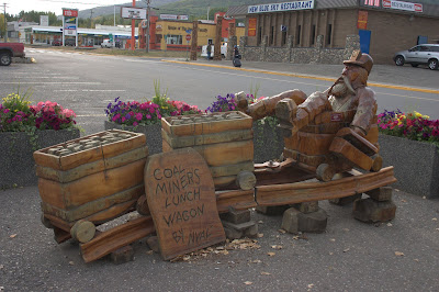
Spent last night in Chetwynd, Chain Saw Sculpture Capitol of the World. This is the largest town we had seen since Whitehorse. About 2600 folks.
 |
| Wood sculptures were all over the town. |
The drive down to Prince George was slow and wet. Lots of escorted construction through muddy, slippery areas. Saw some mountains being systematically dismantled for coal mining – the highway forms a boundary with the largest coal deposits in North America. At 80,000 people, Prince George is the biggest town we have been in since Anchorage, but it isn’t a tourist town. Lots of industry and not that pretty. We were going to spend a full day here checking it out but decided to spend that extra day in Vancouver. Will continue south tomorrow on the Caribou Highway. This is another area where goldrushing occurred around the turn of the century. Expect to get to Vancouver day after tomorrow.
 |
| Russ decided he needed to get some glacier water as a souvenir. |


How do you tell the difference between elk and caribou?
ReplyDeleteCaribou are big deer basically (or giant reindeers). I think elk are a different branch entirely, much smaller. Their antlers are much smaller than caribou. And the caribou's antlers are much more intricate.
ReplyDelete